About the DGFSC
Feed the Future Innovation Lab for Collaborative Research on Sustainable Intensification (SIIL), funded the Digital Tools, Geospatial, and Farming Systems Consortium (DGFSC). We are focused on developing foundational information to support the development of digital support tools that can guide decision-makers and producers to
improve food security, human nutrition, and risk management and resiliency of smallholder farming systems today and in the future.
This consortium provides new information that enhances long-term strategic and short-term adaptive management of smallholder farming systems and increases capacity for extension practitioners and government officials to utilize the outcomes obtained on this project to improve resiliency at the farming system scale.
“We strongly believe that the development of new data products can positively impact smallholders and help them to better adapt to emerging environmental and market pressures".
The long-term goal of the project team is to improve the resilience of smallholder livelihoods through the application of digital geospatial tools for managing and enhancing productivity, economics, environmental, and social aspects of human wellbeing.
Our Mission
The DGFSC will focus on developing resilience-relevant data. These datasets can be used in digital platforms to inform USAID and local policymakers to better strategies in helping vulnerable populations by building resilience to environmental stressors such as climate change. Ultimately, these activities enhance current efforts towards achieving the Sustainable Development Goal target of ending malnutrition by 2030. Working collaboratively with institutions across the US and the globe, this consortium will support the mission of the SIIL lab by providing a geospatial integration framework of the five domains of the SIAF.
Our Vision
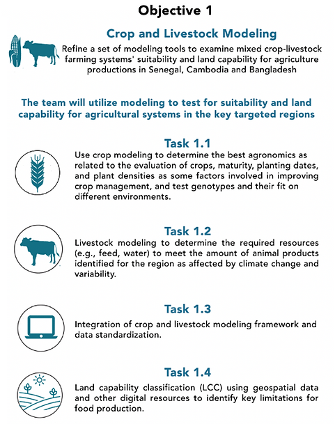
This consortium will build upon the five domains of the sustainable intensification process, developing an interdisciplinary and solution-oriented geospatial framework, integrating remote sensing, farming systems modeling, and geospatial data layers to provide innovative data products to take actions towards more resilient farming systems, benefiting families and communities.
Our Objectives


